Use APKPure App
Get Nautical map (The Netherlands) old version APK for Android


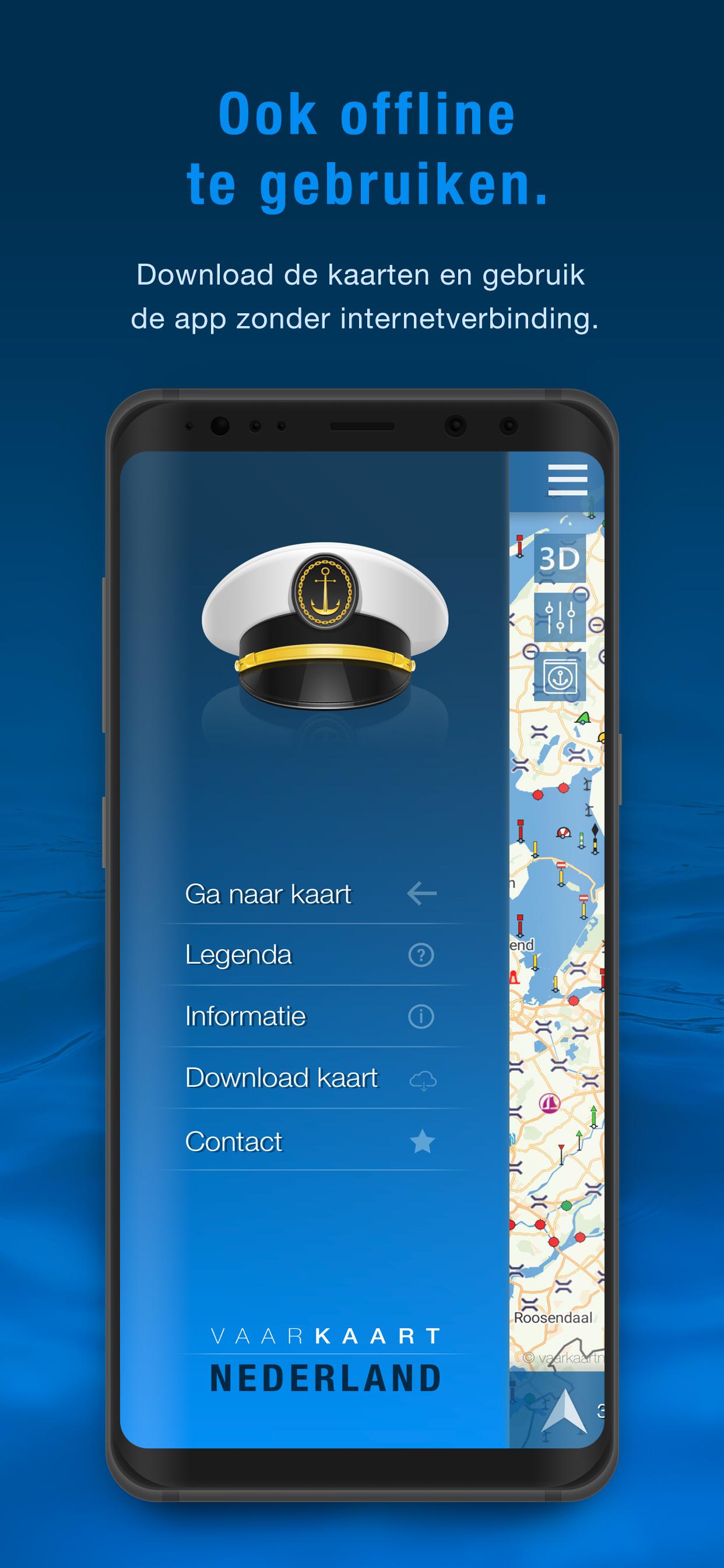


Nautical map (The Netherlands) is an online waterway chart and almanac
Nautical map (The Netherlands) is an online waterway chart and almanac which immediately displays all information relevant when traveling over water in The Netherlands. It is also an great tool to plan your cruise.
Nautical map NL includes:
- More than 8,000 buoys, barrels and other floating waterway markings.
- More than 4,500 docks and warfs.
- More than 2,500 bridges, including height, width and operating times.
- More than 300 locks including operating times.
- Display of current speed and course.
- Graphical representation of the traveled route.
Agreements: http://www.vaarkaartnederland.nl/voorwaarden
Last updated on Feb 19, 2024
- Various improvements and add additional data
- Inland shipping police regulations and other useful or mandatory documents added to the app
- Emergency button with current position and showing emergency numbers
Latest Version
![]() 3.6.0
3.6.0
Uploaded by
Irham Khoirul Yamin
Requires Android
Android 7.0+
Available on
![]()
Category
Report
Discover what you want easier, faster and safer.

Nautical map (The Netherlands)
3.6.0 by AppHero B.V.
Feb 19, 2024