Use APKPure App
Get Oklahoma Lakes GPS Map old version APK for Android


Biển và câu cá Charts - Sức mạnh của một plotter GPS trong lòng bàn tay của bạn
Flytomap is a valid and interesting alternative,
Featured on the Deck
Featured on Geomedia
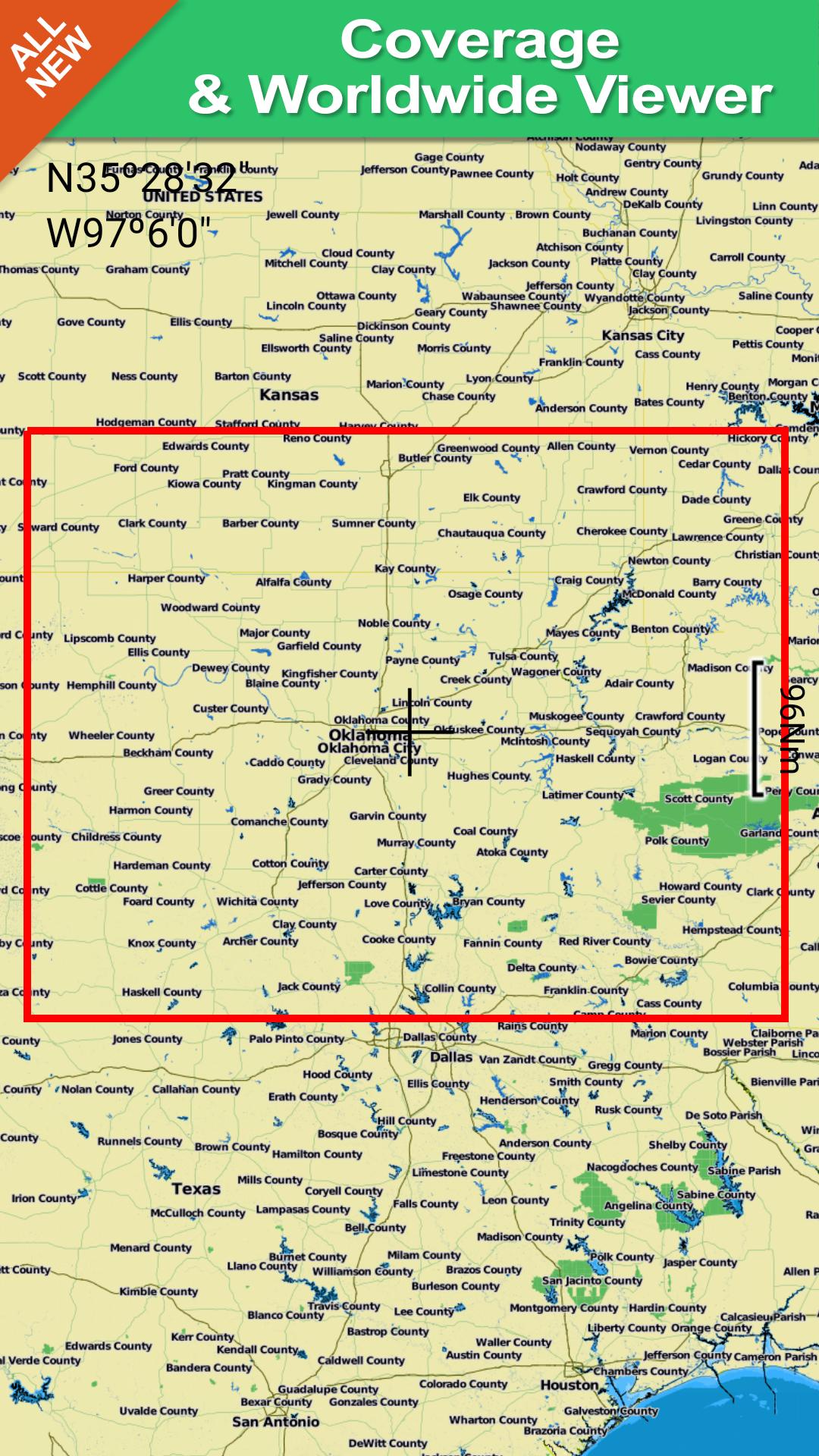
Worldwide Marine and Outdoor Maps available when connected, thanks to viewer.flytomap.com
Worldwide Satellite images overlay on charts
Worldwide Terrain features overlay on charts, thanks to Open Street Map, Open Cycle Map,Earth,topo maps by ESRI
Now with NOAA raster charts seamless with continuous updates from the official Government server
Now with ActiveCaptain - Worldwide boaters community * 200.000 + Captains
Use to Explore:
√ Latitudes and Longitudes to go to your favorite places
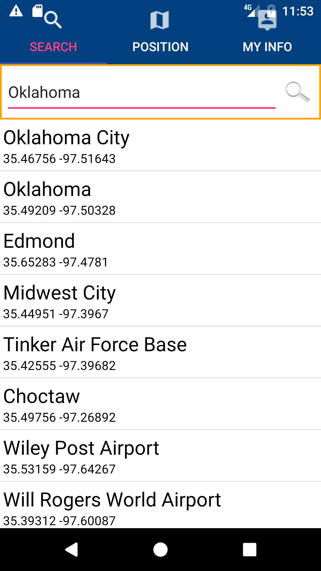
√ Search your Favorite points directly
√ Zoom, Rotate and Pan fast just by a finger touch
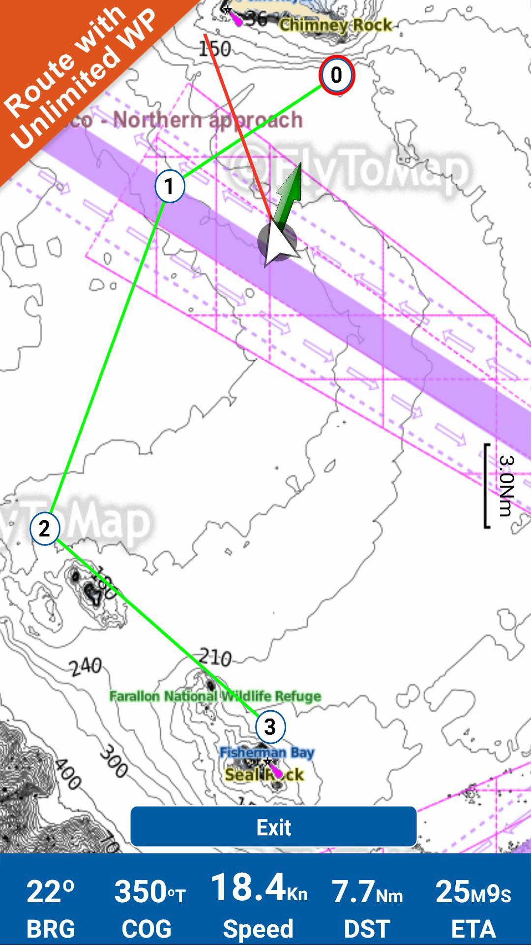
√ Route with unlimited waypoints
√ With Head Up and Course Up feature
√ Geocompass
√ Navigate and see your GPS position on the map
√ Heading Vector Towards the direction movement
√ Distance Measurement Tool to easily calculate the distance from one location to another
√ Insert the target/destination and see in real time your speed, distance and bearing
√ background mode - Flytomap works in background as well, you can swap with another app and receive/make calls send sms while panning and zooming.
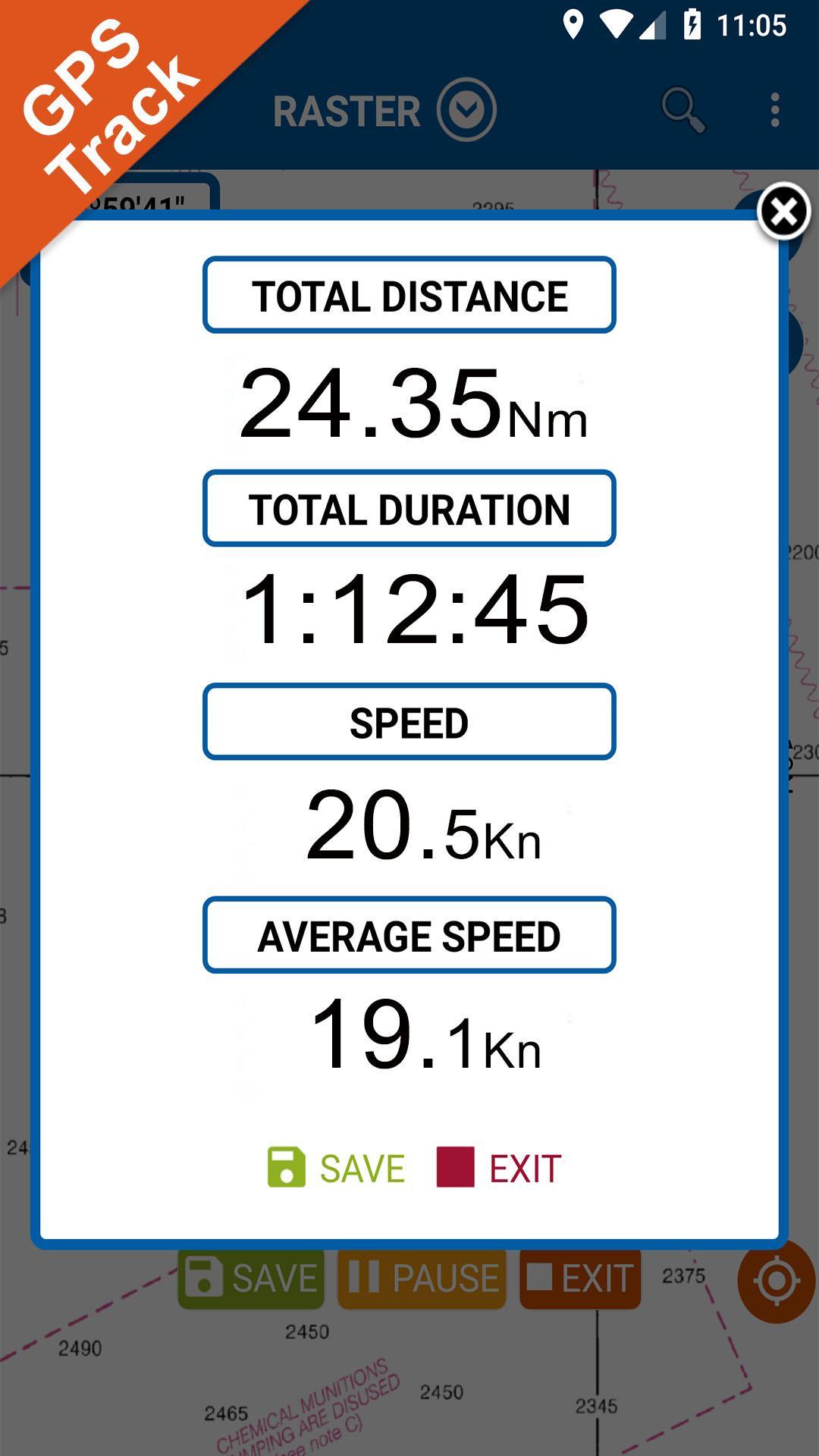
√ Unlimited Tracks share via email, visible on Google, Flytomap Viewer, KMZ format - Store your track without the need of cellular data or mobile signal
√ KMZ KML from / to GPX Converter
√ Optimized battery usage
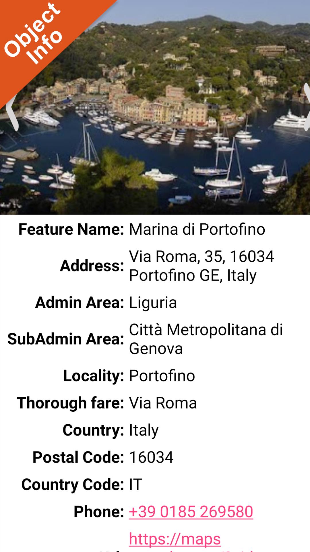
√ ActiveCaptain
• View and contribute to the best boaters community available in the world
√ And so much more to come - It’s the only app you will ever need! Our charts are installed on: GARMIN NAVICO LOWRANCE B&G NORTHSTAR EAGLE SIMRAD
Follow us:
▶Twitter @flytomap
▶Web Site flytomap.com
▶Web App viewer.flytomap.com
▶Facebook facebook.com/flytomap
The entire cartography of Oklahoma Lakes is included in this application
Arcadia
Atoka
Bluestem
Carl Albert
Chandler
Chickasha
Claremore
Coalgate
Dave Boyer (Walters)
Durant
Ellsworth
Eucha
Fort Gibson
Frederick
Grand Lake O' the Cherokees
Guthrie
Healdton
Hefner
Heyburn
Hudson (Bartlesville)
Hudson (Markham Ferry)
Hugo
Hulah
Jean Neustadt
Jim Hall (Henryetta)
Lawtonka
Liberty
Lloyd Chruch
Lone Chimney
McGee Creek
Meeker
Murray
New Spiro
Okemah
Overholser
Pawhuska
Pawnee
Perry
Ponca
Sahoma
Sardis
Scott King
Shawnee Twin 1
Shawnee Twin 2
Spavinaw
Stanley Draper
Thunderbird
W.R. Holway
Waurika
Waxhoma
Wister
Dahlgren
Elmer
EvansChambers
Hall
NanihWaiya
OzzieCobb
Schooler
Vanderwork
Vincent
Watonga
Flytomap is committed to constant improvement, this App is developed with the help of professional boaters to get the best experience on the sea, we listen to our users and systematically add the most requested features.
Thank you for the feedback!
Additional info about Flytomap products
FLYTOMAP LAKE MAPS:
We offer high quality lake maps with detailed information and important features compressed to assure the larger coverage in USA region. Lake maps contain most important DNR lakes with detailed ‘Depth Contours, Boat Ramps, Fishing spots etc. Also includes Trails, Roads and Railways information.
WATER MAPS (Marine):
Water map navigator is the new ‘Marine Navigator for all mobile devices contains embedded Electronic Nautical Charts (ENC) from NOAA compressed to a large coverage.You can now download the application and transform your Phone in a chart plotter with best NOAA, ENC S57 cartography; which includes Anchoring areas, Fishing areas,restriction areas, obstructions, rocks, Buoys, Beacons, Lights, Depth contours with Values display on map, Spot Soundings and more. The only marine app’s available in the market with such huge information. Every effort is made to be as accurate as possible when presenting information for every destination.
“We work to delight your moments”
! Enjoy great Journeys!
Last updated on Dec 22, 2020
Minor bug fixes and improvements. Install or update to the newest version to check it out!
Phiên bản mới nhất
![]() 4.4.3.5
4.4.3.5
Yêu cầu Android
5.0
Available on
![]()
Danh mục
Báo cáo
Discover what you want easier, faster and safer.

Oklahoma Lakes GPS Map
4.4.3.5 by FLYTOMAP INC
Dec 22, 2020
$3.99