下载 APKPure App
可在安卓获取Sifnos topoguide的历史版本


Sifnos岛,基克拉泽斯,希腊的远足和自然指南
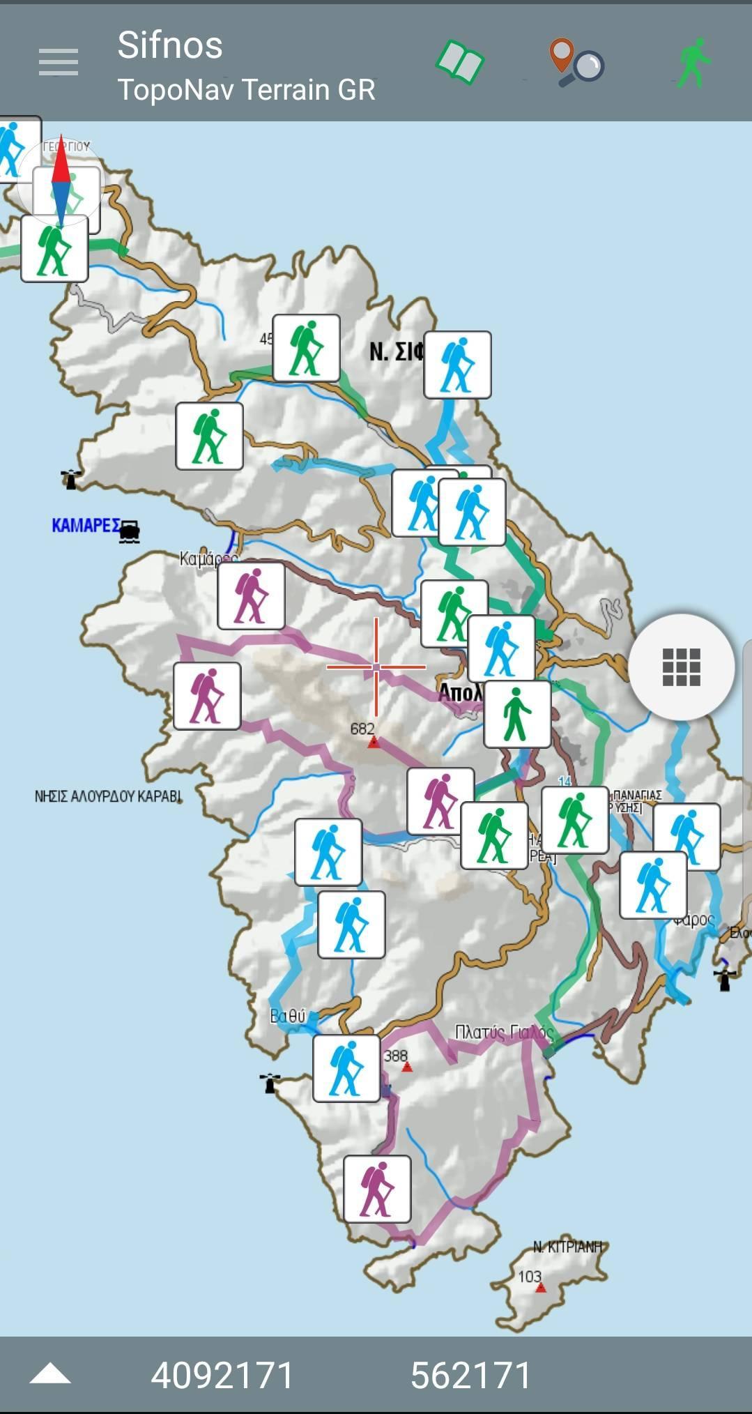
Sifnos topoguide is a digital field guide for hikers and nature lovers visiting the island of Sifnos and exploring the very interesting hiking network Sifnos Trails or the nature richness of this - still unspoiled by the mass tourism - beautiful island of Cyclades. The app includes routes, descriptions and photos for 25 hiking routes.
The application offers detailed offline maps and an extensive introduction on geography, the monuments and the paths of Sifnos island, including a large chapter on the island's nature.
The app offers also a useful list of POIs with a comprehensive search engine.
The trails list includes easy and moderate hiking trails, of a total length of 110 km.
In the field, the app identifies the nearest adventure, guides you to it and then along it by displaying messages and warnings on every junction or other important location. On each Point of Interest, photos and texts are displayed on the map. If the hiker gets off-trail, the app indicates the shorter way to get back safely.
The cartographic company AnaDigit, creator of the application, has issued previously hundreds of detailed hiking maps for Greece (eg. maps of Mt. Olympus, Crete, Zagori, Sifnos, Naxos and other Aegean islands). To build the application and ensuring data accuracy, all paths of Sifnos island have been revised during Spring of 2019.
Last updated on 2021年05月15日
Minor bug fixes and improvements. Install or update to the newest version to check it out!

Sifnos topoguide
1.4 by AnaDigit
2021年05月15日
$6.99